Anambah to Branxton Structure Plan
Client:
Cessnock City Council, Singleton Council and Maitland Council
Capabilities:
Context
The Anambah to Branxton corridor represents one of the Hunter region’s most significant opportunities. Stretching approximately 19 kilometres across the Cessnock, Maitland and Singleton local government areas, the corridor has the potential to accommodate substantial housing, employment and infrastructure investment – leveraging its strategic connectivity to Greater Newcastle and the Upper Hunter.
Rapid growth within the corridor had created an urgent need for a coordinated approach to land use and infrastructure planning. Without a shared framework, the three councils faced the risk of fragmented and out-of-sequence development, increasing demand on existing infrastructure and missed opportunities to shape a connected, liveable and sustainable region.
We were engaged by Cessnock City Council to lead the preparation of the Anambah to Branxton Corridor Structure Plan – a strategic planning initiative funded by the Federal Governments Housing Support package and requiring delivery coordination across three levels of Government. The project seeks to establish a clear, evidence-based framework for future growth, bringing together land use planning, infrastructure requirements and development staging across local government boundaries.
Our Approach
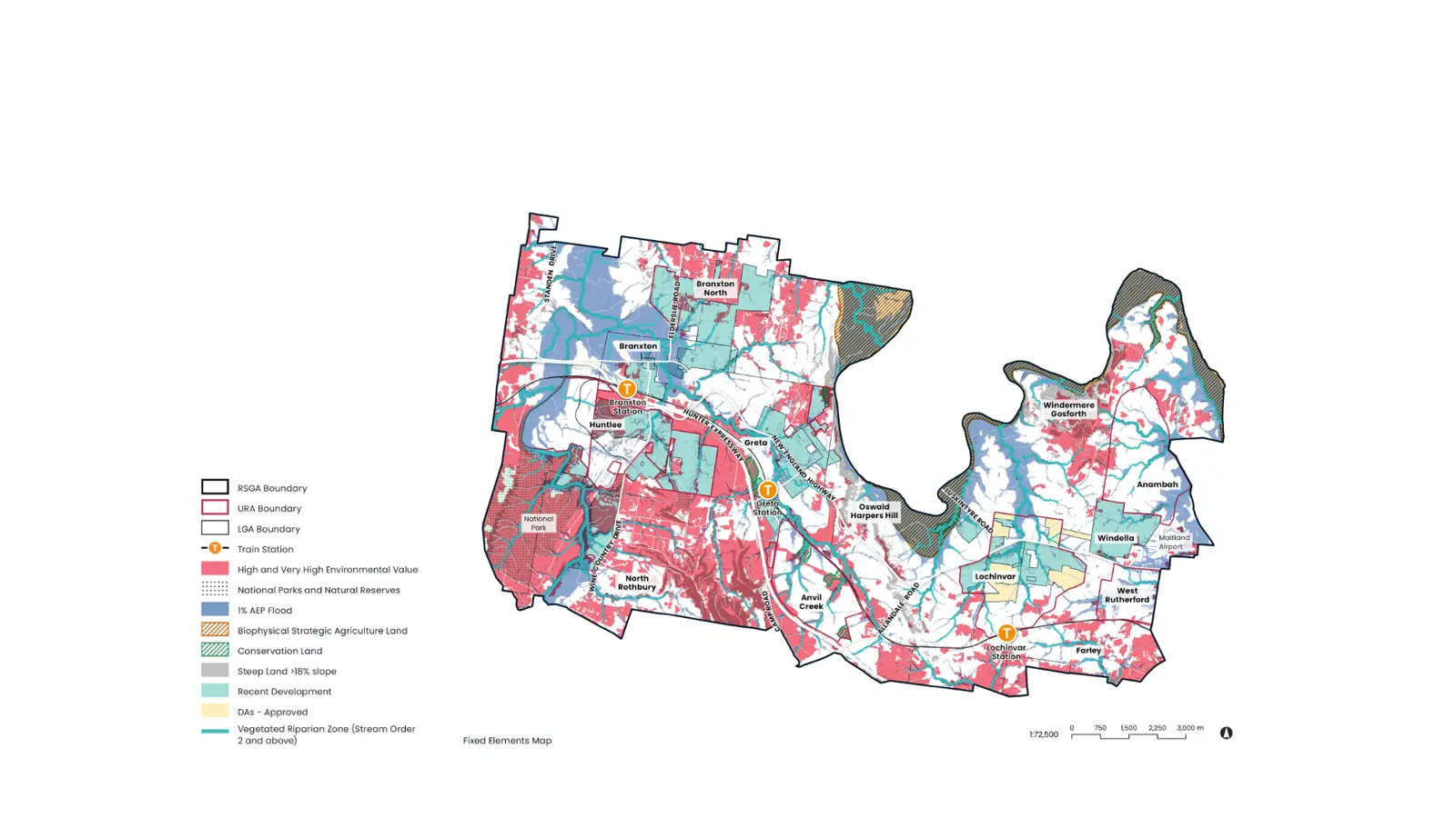
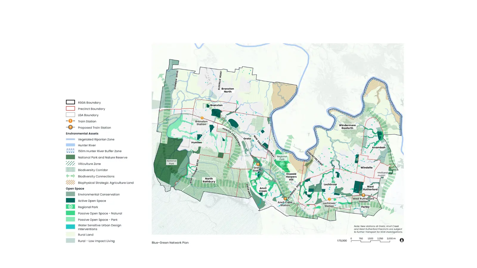
Our multidisciplinary team brought together strategic planning, urban design, transport, economics, environmental and engineering expertise, heritage, engagement and spatial analysis. Working as one integrated team enabled us to consider land use, infrastructure and design together, rather than addressing these complex and interconnected issues in isolation. The project’s evidence base also addressed matters including social infrastructure, flood and water-cycle management, utilities, bushfire, biodiversity, geotechnical conditions and infrastructure funding.
Our approach was vision-led and iterative, balancing ambitious, future-focused thinking with the practical realities of landowner aspirations, market conditions and infrastructure delivery. Rather than beginning with a fixed plan, we worked with the three councils, government agencies, service providers and technical specialists to explore and test alternative futures for the corridor. Scenario testing examined different combinations of growth, land use and infrastructure, helping stakeholders understand the choices, dependencies and trade-offs associated with each pathway.
This process established the long-term vision first and then used technical evidence to test and strengthen it. It enabled ambitious outcomes to be balanced with market feasibility, landowner aspirations, servicing constraints and the practical realities of infrastructure delivery.
Cross-council and state government agency collaboration was critical. Through Investment Logic Mapping, Enquiry by Design and other targeted workshops, the project created opportunities to test assumptions, build shared understanding and align priorities across the corridor. It shifted the conversation beyond individual sites and council boundaries towards a shared regional outcome and a coordinated platform for ongoing advocacy and investment.
"A shared, evidence-based framework will help the three councils, state and federal government to coordinate investment for growth and infrastructure across what is one of the Hunter’s most significant growth corridors.”
Impacts and Benefits
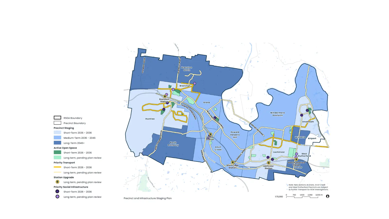
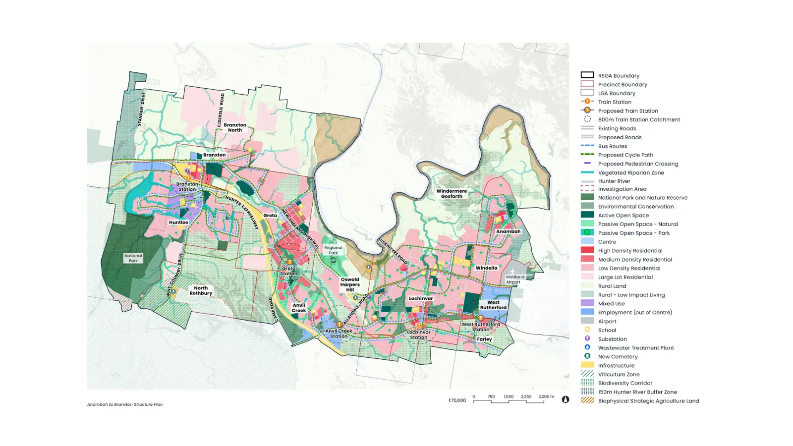
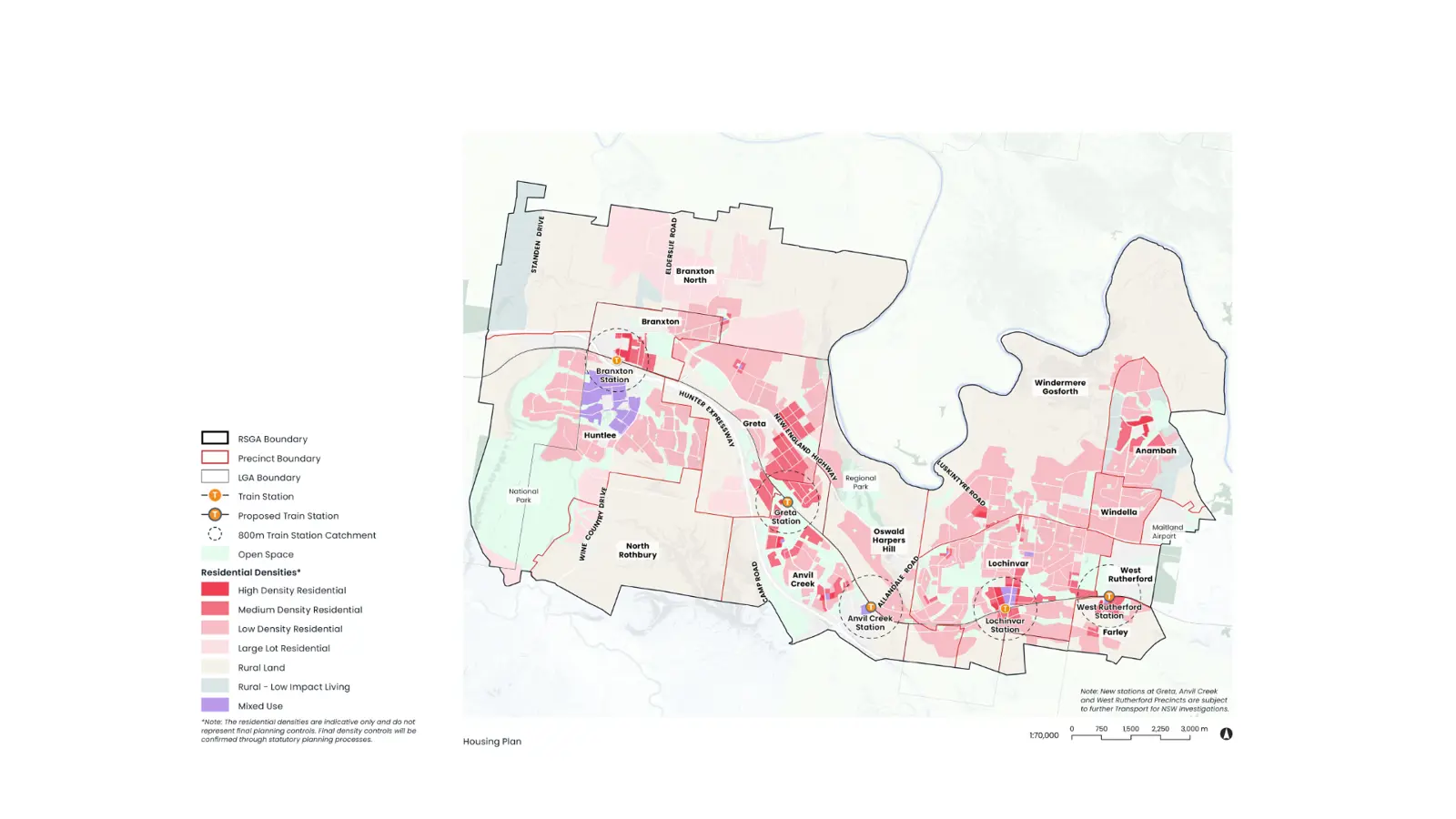
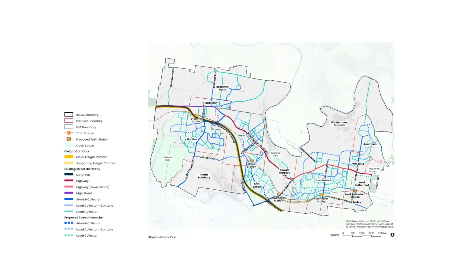
The Structure Plan will provide councils and regional stakeholders with a coordinated framework for managing growth across the corridor. It will clearly identify future land uses, infrastructure needs and staging considerations, helping decision-makers align development with infrastructure capacity and regional priorities.
Importantly, the project demonstrates that greenfield development and transit-oriented development are not competing alternatives. Well-planned greenfield growth can deliver feasible housing in the near term while safeguarding the strategic transport corridors, centre locations, connected street networks and larger sites needed to support future intensification.
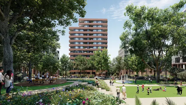
The framework recognises that successful centres and transit-oriented communities evolve over time. Early development can build the population needed to support services, amenity and infrastructure, while the Structure Plan protects opportunities for more diverse housing, employment, public transport and higher-density development as the corridor matures. In this way, the project provides a pathway from greenfield growth today to more connected and transit-oriented communities tomorrow.
The work also gives the councils a stronger collective basis for coordinating with government agencies, infrastructure providers and funding partners into the future. By aligning a shared vision with an integrated evidence base, infrastructure planning and an implementation pathway, the project supports more confident decision-making and coordinated advocacy across all three local government areas.